
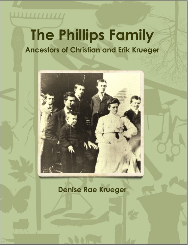
A photo of the old family farm came up in email conversation recently.
That led to some questions. Which led to more questions. Which led to this family historian spending a bit of time looking for answers.
While others in the email conversation likely quickly moved on to more interesting things in their lives, their family history obsessed sister-in-law decided to put findings about what we’ll label the farm in this post.
– Denise
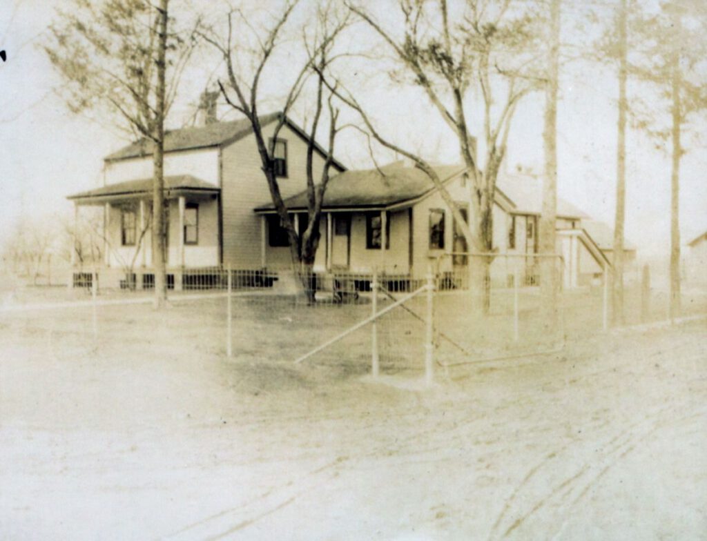
We consider this the house on the Phillips farm. It has been in the Phillips family for 99 years. Part of it is still occupied by Phillips family. But, the farm has a long history that pre-dates the name Phillips.
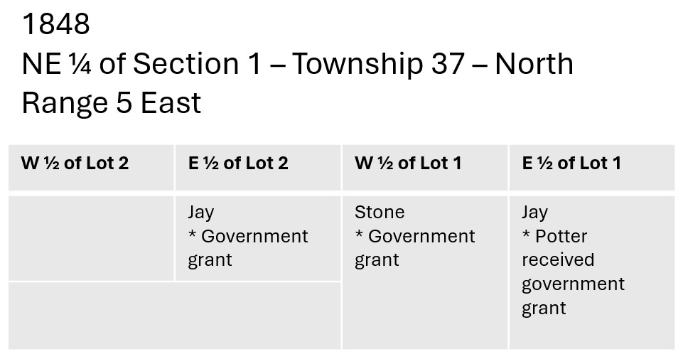
United States Government Land Grants
The history explained here is that of white settlers. However, Indigenous Peoples including the Illinois, Miami, Winnebago, Fox and Sacs (Sauk), Kickapoo, and Pottawatomi tribes lived on and traveled through the area for thousands of years prior to that. In the mid-19th century, most of the tribes were removed from Illinois by the federal government through either war or resettlement.1
With its previous occupants removed, the United States Government allocated the land to citizens. Some of the land grants were awarded to reward miliary service. The earliest grantees were not always interested in settling on the lands they were granted.
Two examples of this were James O’Hara and Lewis Scrivner. O’Hara was awarded a land grant after serving as a private in Captain Rains Company Seventh Regiment United States Infantry. Scrivner was a private in Captain Dickinson’s Company Tenth Regiment, United States Infantry. Instead of accepting their land, both men assigned it to others who became the first owners of parts of what became the farm. Isaac Hatch was the assignee for Lewis Scrivner and John Lewis was the assignee for James O’Hara.
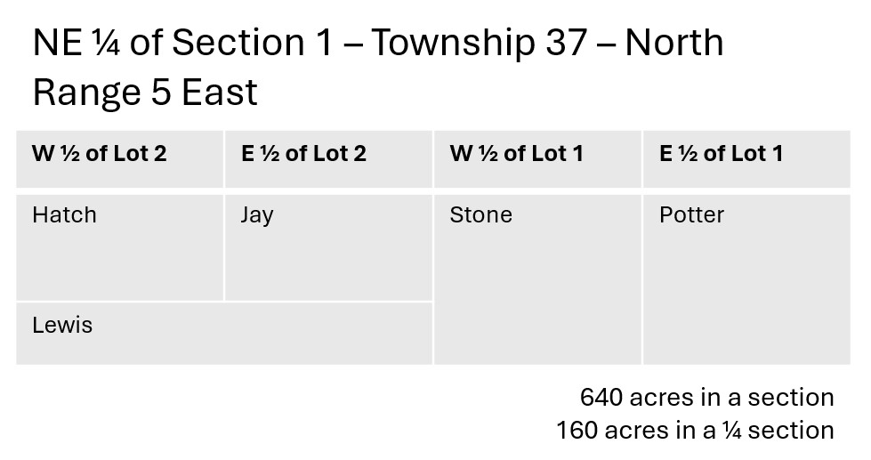
In addition to Hatch and Lewis, there were three others who were given parts of the farm in grants from the US General Land Office.
A close observer will note that there is an overlap of ownership. How could John Lewis be awarded all of Lot 2 when parts of it had already been allotted to Isaac Hatch and Sylvester Jay? That question has not yet been answered.
| Date | Grantee | Property Description |
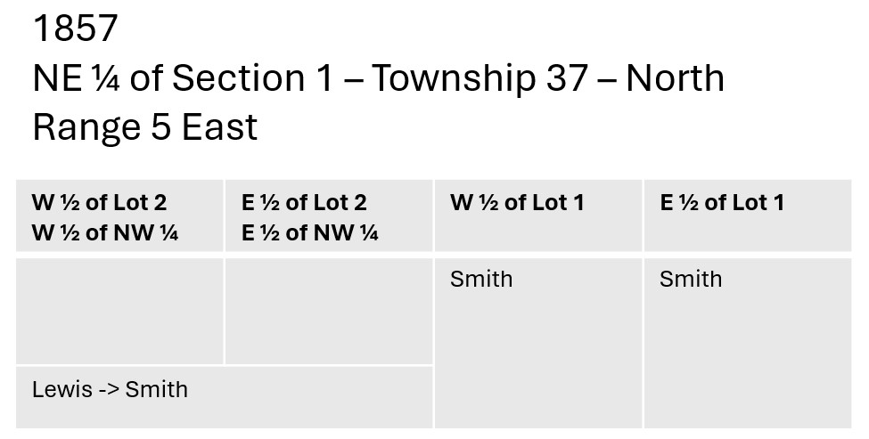
| 01 Feb 1848 | Sylvester Jay | E ½ of Lot No 2 of the NE ¼ of Sec 1 T37 NR 5E – 50 and 61/100th acres2 |
| 01 Mar 1848 | Lorenzo D. Potter | E ½ of Lot No 1 of the NE ¼ of Sec 1 T37 NR 5E – 40 and 4/100th acres3 4 |
| 10 Mar 1848 | Perley Stone | W ½ of Lot No 1 of the NE ¼ of Sec 1 T37 NR 5E – 40 and 4/100th acres5 |
| 10 Aug 1850 | Isaac Hatch, assignee of Lewis Scrivner | W ½ of Lot 2 of the NE ¼ Sec 1 T37 NR 5E (and additional property) – totaling 120 40/100th acres6 |
| 01 Aug 1851 | John Lewis, assignee of James O’Hara | Lot 2 NW Sec 1 – T37 – NR 5E7 |
Land Speculators?
After the land was initially granted to white owners, there was a flurry of activity. There were purchases and sales and eventually consolidation.
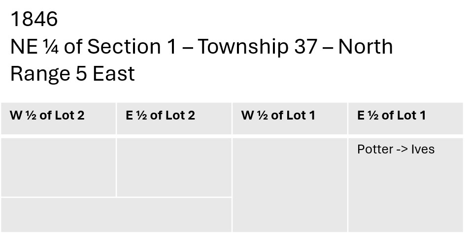
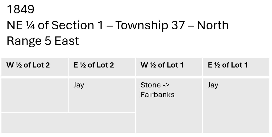
According to the records, the parcel of land granted by the government to Lorenzo D. Potter was sold twice before Potter even received the grant. How that could be allowed is another unanswered mystery.
Based on the available records and the way they are indexed (or not), the following are at least a good number of the transactions that involved the lands that eventually made up the farm.
| Date | Grantor | Grantee | Price | Physical Description |
| 08 Sep 1846 | Lorenzo D. Potter | Enos Ives | $200 | E ½ of Lot No 1 of the NE ¼ of Sec 1 T37 NR 5E – 40 and 4/100th acres8 |
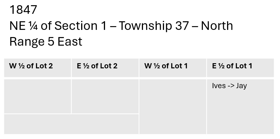
| 07 May 1847 | Enos Ives | Sylvester Jay | $55.20 | E ½ of Lot No 1 of the NE ¼ of Sec 1 T37 NR 5E – 40 and 4/100th acres9 |
| 01 Feb 1848 | US Government General Land Office | Sylvester Jay | E ½ of Lot No 2 of the NE ¼ of Sec 1 T37 NR 5E – 50 and 61/100th acres | |
| 01 Mar 1848 | US Government General Land Office | Lorenzo D. Potter | E ½ of Lot No 1 of the NE ¼ of Sec 1 T37 NR 5E – 40 and 4/100th acres | |
| 10 Mar 1848 | US Government General Land Office | Perley Stone | W ½ of Lot No 1 of the NE ¼ of Sec 1 T37 NR 5E – 40 and 4/100th acres | |
| 12 Apr 1849 | Perley Stone | Alanson Fairbanks | $80 | W ½ of Lot No 1 of the NE ¼ of Sec 1 T37 NR 5E – 40 and 4/100th acres10 |
| Date | Grantor | Grantee | Price | Physical Description |
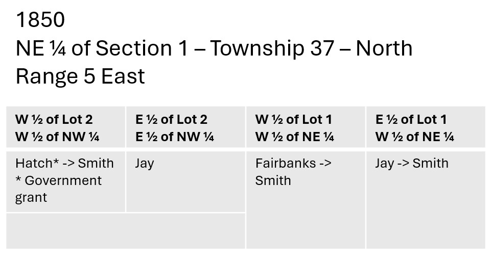
| 13 Jun 1850 | Alanson Fairbanks | Nathanial Smith | $160 | W ½ of Lot 1 of NE ¼ Sec 1 T37 NR 5E11 |
| 10 Aug 1850 | US Government General Land Office | Isaac Hatch | W ½ of Lot 2 of the NE ¼ Sec 1 T37 NR 5E (and additional property) | |
| 17 Aug 1850 | Sylvester Jay | Nathaniel Smith | $385 | E ½ of Lot No 1 of NE ¼ Sec 1 T37 NR 5E12 |
| 17 Aug 1850 | Isaac Hatch | Nathaniel Smith | $140 | NW 1/4 of the NE 1/4 of Sec 1 T37 NR 5E – 50 and 50/100th acres13 |
When the 1850 Federal Census was taken, none of the owners was living on any of the land of the farm. At this point, we can assume that the land was undeveloped.
- Sylvester Jay, a 29-year-old blacksmith, was recorded living with his family in Little Rock, Kendall, Illinois.14
- Alanson Fairbanks, a farmer, age 41 was recorded living with his family in Little Rock, Kendall, Illinois.15
- There were no Nathaniel Smiths listed living near De Kalb County, Illinois. When he purchased property from Alanson Fairbanks in August 1850 his address was Saratoga County, New York.
| Date | Grantor | Grantee | Price | Physical Description |
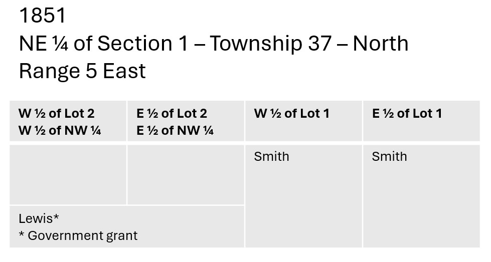
| 01 Aug 1851 | US Government General Land Office | John Lewis | Lot 2 NW Sec 1 – T37 – NR 5E | |
| 21 Sep 1857 | John Lewis | Nathaniel Smith | $800 | Lot 2 NW Sec 1 – T37 – NR 5E |
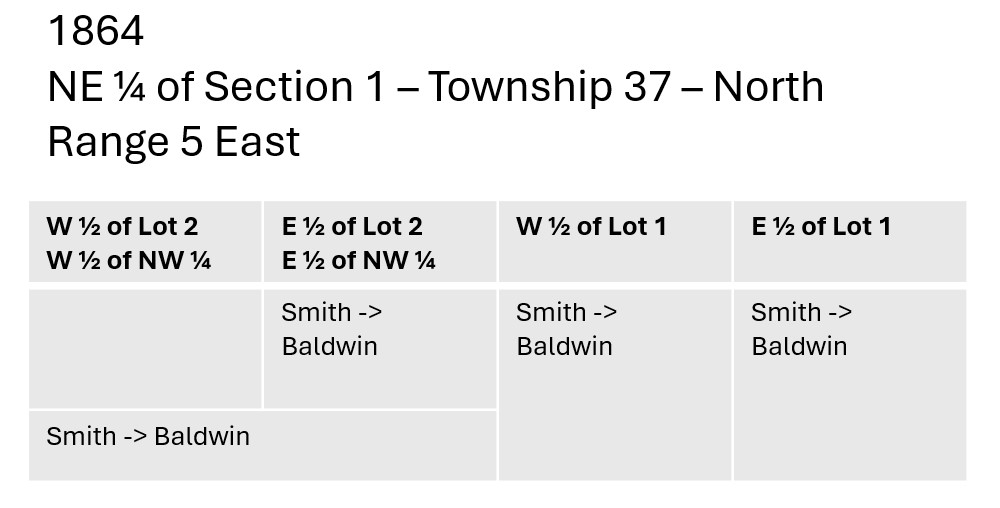
By the time the 1860 Federal Census was taken, Nathaniel Smith owned all the land that made up the farm. It does not appear, however, that Smith lived on that land. A 45-year-old Nathaniel Smith was found living nearby in the town of Sycamore, De Kalb County. Though relationships were not listed in that census, it appears that he was a boarder in the household of Susan Leavitt who was listed as a housekeeper. Nathaniel Smith’s occupation was shown as “Miner.”16
| Date | Grantor | Grantee | Price | Physical Description |
| 30 Sep 1864 | Nathaniel Smith | Franklin Baldwin | $3,900 | Part of E ½ & all of W ½ Lot 1 – & E ½ Lot 2 of NE ¼ & NW ¼ NE ½ all of Sec 1 – 37 – NR 5E17 |
From 1850 through 1857, Nathaniel Smith bought conjoined parcels of land, spending $1,485 in total according the land records that have been cited. In 1864, he sold everything to Franklin Baldwin for $3,900. Baldwin now owned the lands of the farm.
The Stolp Farm
Ludwig Stolp, his wife Catherine, and their oldest children arrived in the United States in 1856. After living in Somonauk, De Kalb, Illinois, for a year, and Yorkville, Kendall, Illinois, for many more, he purchased the farm. On 13 Oct 1866, Ludwig Stolp purchased “W ½ of Lot 1 of NE ½ of Sec 1 T37 NR 5E and E ½ Lot 2 NE ¼ of Sec 1 T37 NR 5E” from Franklin Baldwin for $5,600.
When Baldwin bought the land in 1864, he was listed as being from La Salle County, Illinois, and when he sold it to Stolp in 1866 he was still listed as being from La Salle County. It is probable that he never lived on the property. But, he did make a good profit on the land that he only owned for a couple years.
| Date | Grantor | Grantee | Price | Physical Description |
| 13 Oct 1866 | Franklin Baldwin | Ludwig Stolp | $5,600 | W ½ of Lot 1 of NE ½ of Sec 1 T37 NR 5E and E ½ Lot 2 NE ¼ of Sec 1 T37 NR 5E18 |
Who built the original farmhouse on the farm?
The land records do not tell us, but based on what can be known about the previous owners, it seems likely that Ludwig Stolp built the original house and barn.
A 2009 article in the Sandwich Record reported on the Phillips family holding reunions and noted, “The house and the barn date back to the time when Ludwig and Catherine Stolp, who emigrated from Germany settled on the farm.“19
Through the years, additional land transactions were made to increase the size of the farm.
The Miller Farm
Born on her parents’ farm, Mary Stolp was the youngest child in the large Stolp family. Her father died in 1894 when Mary was only 23-years old. Her mother died three years later. Mary married to Frank Palmer Miller on 29 Dec 1897, two weeks after her mother’s death. A newspaper article announcing their marriage said, “Mr. and Mrs. Miller expect to reside on the Stolp homestead.”
The couple formally purchased the farm from Mary’s mother’s estate on 07 Feb 1900. They, along with Mary’s brother Lewis, purchased the land from Mary’s other seven siblings. The Millers had a ¾ share in the property and Lewis got ¼.
| Date | Grantor | Grantee | Price | Physical Description |
| 07 May 1883 | Martha F. Wilson | Ludwig Stolp | $500 | Two acres of land in Lot 1 – NW ¼ of Sec 1 T37 NR 5E20 |
| 07 May 1883 | Edd Stolp and Nettie, his wife | Catherine Stolp | $2,000 | 15 and 85/100th acres in the NW ¼ of Sec 6 in T37 NR 5E. 21 64/100th acres in the NE ¼ of Sec 1 T37 NR 5E21 |
| 07 Nov 1895 | Katherine Stolp, and her children, heirs of Ludwig Stolp | Bathsheba A Hummel | $300 | Two acres of land in Lot 1 – NW ¼ of Sec 1 T37 NR 5E22 |
| 07 Feb 1900 | Seven children of Ludwig and Catherine Stolp. | Frank P. Miller and Mary Miller (3/4 share) and Lewis Stalp (1/4 share) | $12,561.11 | W ½ of Lot 1 of NE ¼ of Sec 1 T37 NR5 E ½ of Lot 2 of NE ¼ of Sec 1 T37 NR5 E ½ of Lot 1 of NE ¼ of Sec 1 T37 NR5 Part of Sec 1 T37 NR 5E23 |
A month later, Lewis, who was 42-years-old at the time, bought a lot in nearby town of Hinckley.24 This all gets quite confusing, because a year earlier, Lewis had paid $1 for his brother Theodore’s interest in the family property.25 Yet, Theodore, along with six of his siblings, was involved in the sale to Frank and Mary and Lewis.
Questions lead to more questions!
According to his obituary, Lewis moved to California in November of 1900, the same year that the farm passed to him along with the Millers. So he was not around to farm his share of the land.
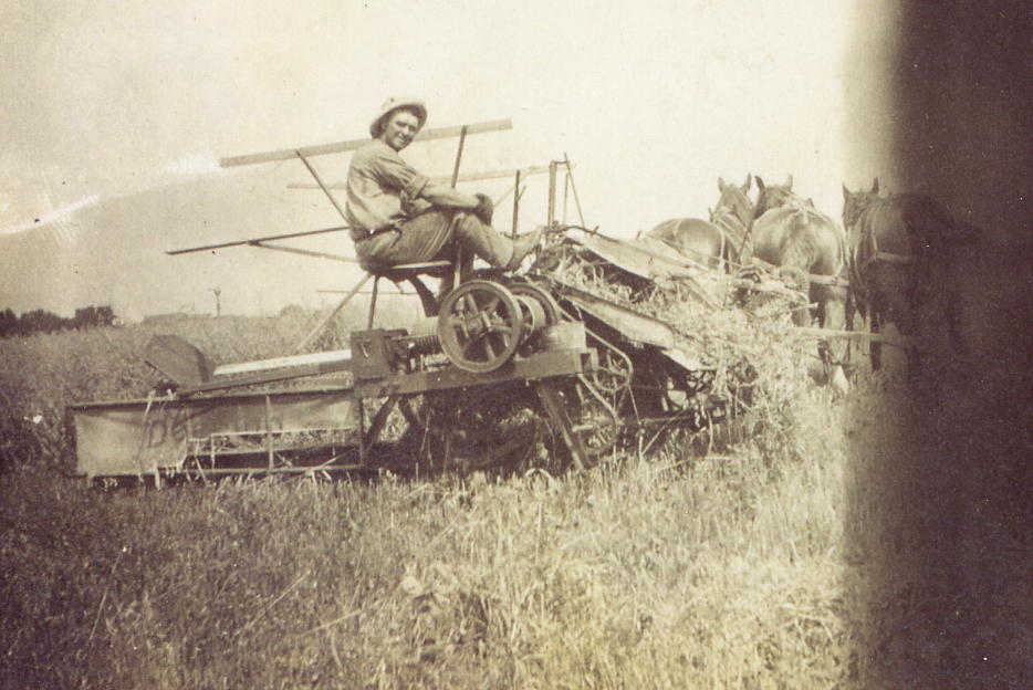
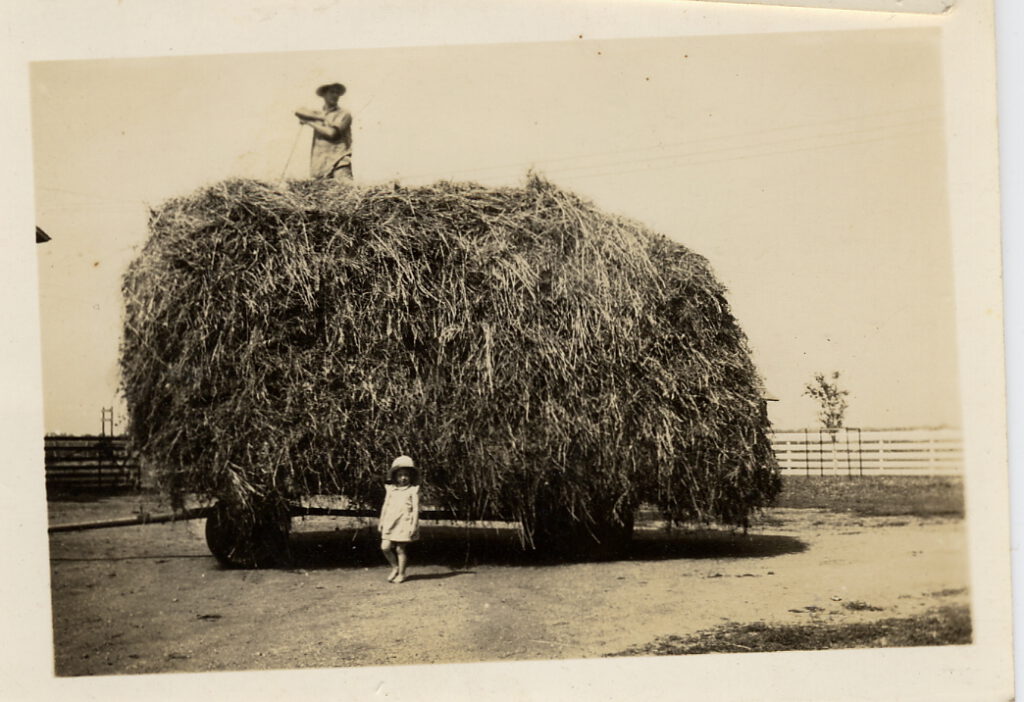
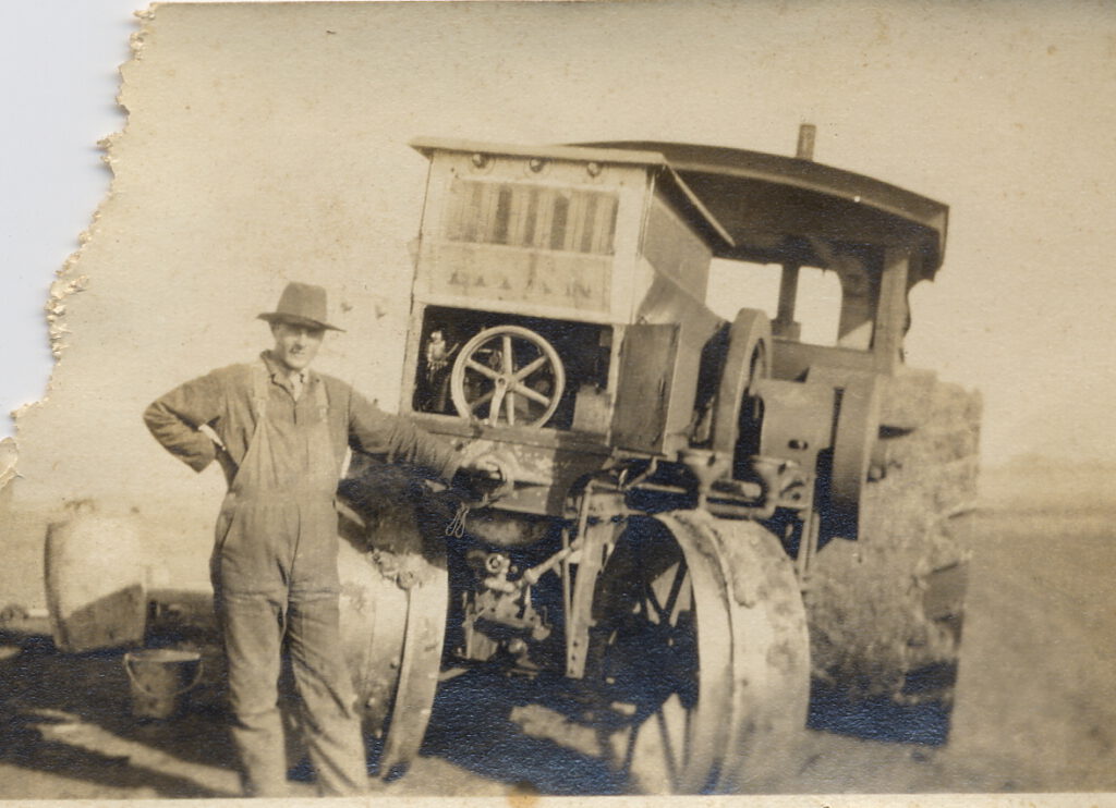
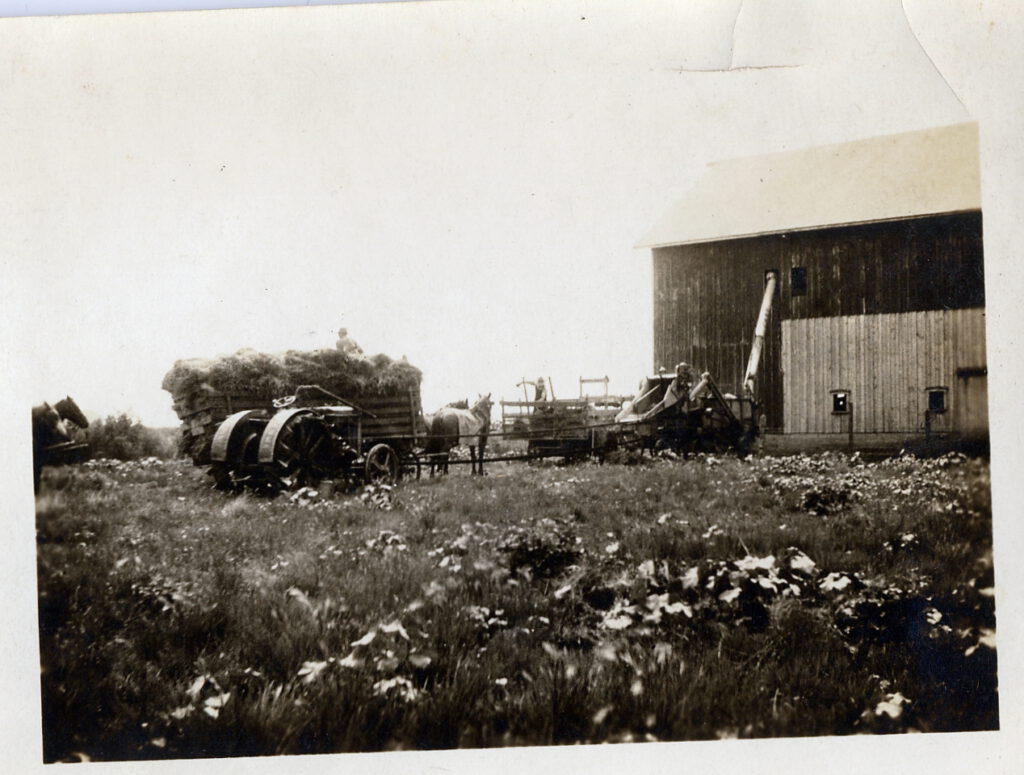
Mary and Frank farmed and raised their daughter, Leona, on the farm. Leona’s diary gave glimpses to day-to-day activities on the farm.
“Cloudy. Pa went to town and John took down a load of oats…”
“Cloudy. I went to school. We washed. Pa butchered the calf.”
“Pa and Ma went to the Farmers club at Burnam. Took White Sox down to get shod…”
“…Pa got caught in the corn slicer. He hauled hogs for John. John hauled corn for McMaster. Not very cold…”
“…Pa got some Plymouth rock roosters.”
“The sun shone. Papa and John butchered three hogs. One for John and two for us. Mamma and I went to Little Rock after some groceries.”
“The sun shone… Pa finished planting corn…
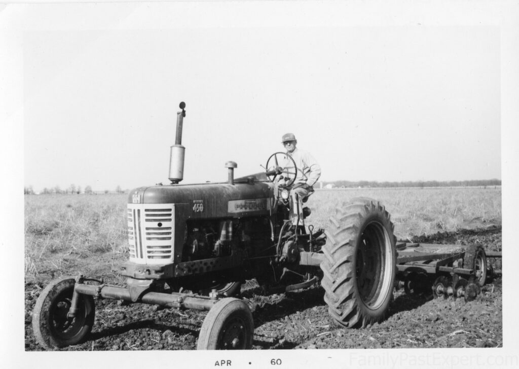
Leona Catherine Miller, 1914
Frank and Leona Miller
Mary, Frank, and Leona had a comfortable and happy life on the farm. But then Mary got sick.
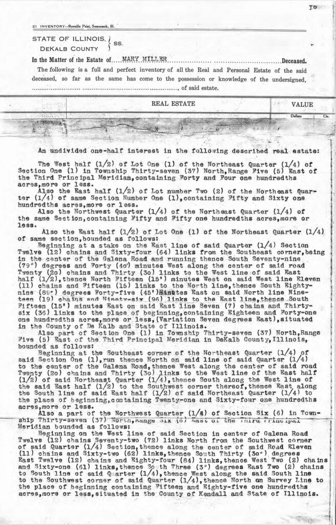
Mary Stolp Miller knew she was dying. One her last day, she took time to make her last will and testament. She left all her property, real, personal, and mixed to her only child, Leona. It seems that at the time, a married couple shared ownership of property. This meant that Leona and her father became equal owners in the farm. Though, there were stipulations. Leona had to leave the property as it was until she was 22 years old, and her father was to act as executor.26
For the second time, property passed to a daughter. It is rather unusual that the farm stayed in the family along female lines. But, since Leona was an only child, she had no brothers to fight for the property. It seems like a big deal that in 1915, when women could not even vote, that a 15-year old girl could be half owner in a 194-acre farm that included farm equipment, horses, cows, pigs, poultry, grain and household goods.
The real estate included in Mary’s estate (her half of the farm) was appraised at $14,000. It included the De Kalb County land: W ½ of Lot 1 of NE ¼ Sec 1 T37 NR 5E (40 4/100th acres), the E ½ of Lot 2 of NE ¼ Sec 1 T37 NR 5E (50 60/100th acres), the NW ½ of the NE ¼ Sec 1 T37 NR 5E (18 41/100th acres), the E ½ of Lot 1 of NE ¼ Sec 1 T37 NR 5E, and part of Sec 1 in T37 NR 5E (21 64/100th acres). It also included a part of the NW ¼ of Sec 6 in T37 NR 6E (15 85/100th acres) situated in the County of Kendall.
Frank became a single parent to a teenaged daughter. Based on her diary entries, it seems that Leona and Frank took care of each other.
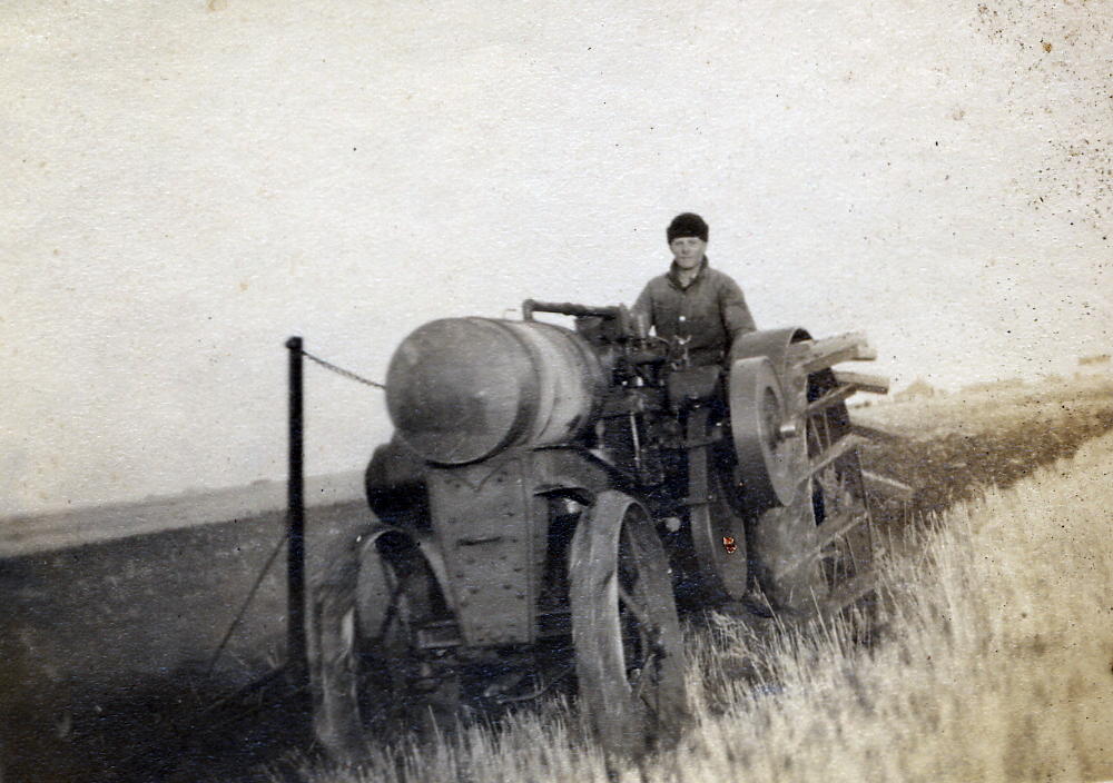
“Cloudy and rained. I drove the auto to town. Pa took the horse and things down and we came home together.”
“The sun shone. Pa took me to school and came after me because Tommy got down in the stall and couldn’t go. …”
“The sun shone. We washed, baked a cake, a pie and a batch of cookies. Went to town in the afternoon.”
“Nice. The sun shone. Took old prince home to Stolp’s. I drove Tommy. Papa ironed.”
“Cold, windy rainy. April fooled dad proper then he fooled me. …”
Leona Catherine Miller, 1915-1917
Frank was into improvements and modernizations–having an indoor toilet early on.
Coralee, 2024
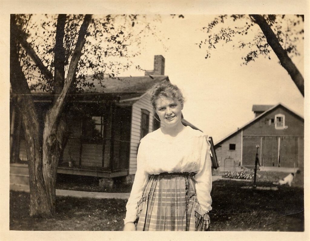
Leona finished high school and began a lengthy long-distance courtship with Floyd Phillips who spent his summers farming in Canada.
Frank and Leona continued living together on the farm. From her letters to her beau, we can see that some days were better than others for Frank and Leona.
Thought I’d get this written last night but dad was looking for someone to take to the movie. I asked if I wouldn’t do he pondered then reluctantly said “Y-e-s.” ‘Twas a poor show – about tough Bowry guys and stealing and killing and all that. ‘me no lika.’ We never got home untill 9:30. I have just about been tired to death to-day.
Dad has been having a terrible cold. Went over to the doctor Monday night. He gave him some medicine that was really supposed to be taken from the bottle internally. I can’t see that it is helping him much but he thinks it is. I never can do much doctoring with a cold. Seems it has to hang on about so long anyway.
Brrrrr – cold day – a north west wind that howls around the corners. Dad just knows that nothing is going to grow. About half the farmers around the country are planting corn again. Dad hasn’t had to do that.
Its most eight oclock I guess I’ll eat my supper. I hate to eat alone but dad hasn’t come yet. He said he’d likely be late
“…dad took us to the fair…”
“Pretty soon we’re going to run opposition to the junk men in Sandwich. Dad has bought another old Ford – truck this time. Now he’s dismanteling the old little truck to make the big one go. I suppose it is the same thing that causes big boys to take Fords apart, as causes little boys to tinker old alarm clocks – that’s supposed to be a joke.”
Leona Catherine Miller letters to Floyd Boyce Phillips, 1923-24.
The Phillips Farm
Leona’s father, Frank Miller, died suddenly on 16 Mar 1925.
Leona became the sole owner of the farm. at age 25.
A month later, on 17 Apr 1925, Leona married Floyd Boyce Phillips.
This is the minute that the property became The Phillips Family Farm.
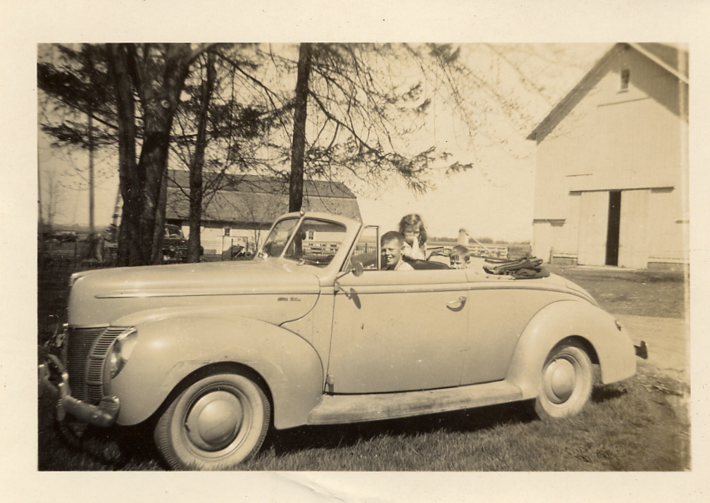
Floyd and Leona raised their three children on the farm in the original farmhouse. In the 1950s, they built a modern house nearby but continued to farm the original land.
As far as remodeling is concerned, there were two upstairs bedrooms—one little one at the end of the stairs, which was mine with a twin bed and small closet. The other was good-sized, and Rusty occupied it. Before our new house was finished in 1952, Stuart, Betty and the twins came to live with us while the hired man occupied their house. My twin bed was behind the dining room door. When we moved into the new house, I had a huge bedroom, which my parents said I deserved.
I believe the old farmhouse had some changes to the living room, such as a smoking area for Grandpa and his pipe, followed by some sleeping areas. Incidentally, I originally slept in a tiny bedroom between my parents’ bedroom and the dining room. Visitors hung their coats in the bedroom closet, and my brothers chased each other through the room in the daytime. I slept in my baby crib until around 5 years old. Then my parents bought a twin bed that could fit in the room. I had one window that overlooked the stairway to the basement from the back door.
Coralee, 2024.
Still in the family
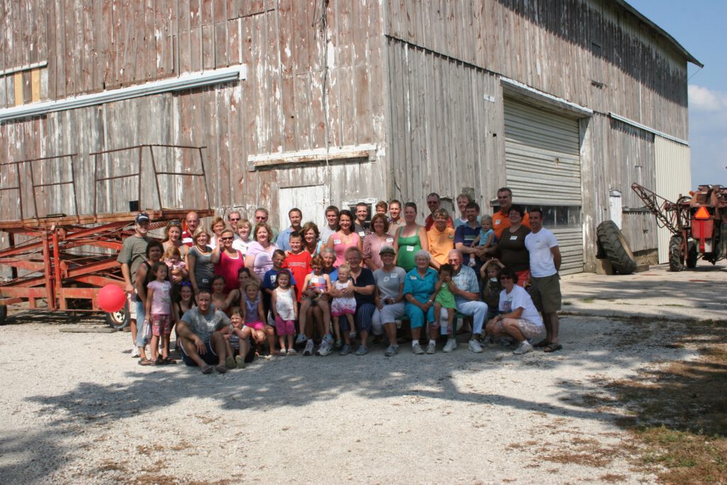
Nearly fifty years after the deaths of Floyd and Leona Phillips, the farmhouse is still standing and occupied by Phillips descendants. A grandson raised his family there and has welcomed extended family to the original farm place for reunions.27
Neighbors and people who want to leave Chicago and its suburbs for a taste of country can visit the farm as well to purchase produce such as sweet corn and asparagus. (Asparagus! There are stories to tell about asparagus too.)
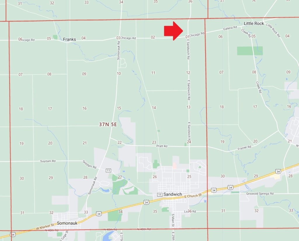
17735 Chicago Road, Big Rock, Illinois
Where can I learn more?
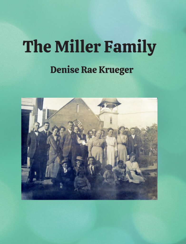
The Miller Family
- Publication date: October 2022
- Pages: 548
- 548 pages
- Formats:
- This book explores our Miller family history. It traces hundreds of descendants of Zachariah Miller who lived most of his life in Rensselaer County, New York. Detailed biographies are provided for the families of our direct line from Zachariah Miller through George Leifheite Miller and Frank Palmer Miller who farmed in Illinois.
The Phillips Family
- Publication date: September 2015
- Pages: 432
- Formats:
- This book traces our Phillips ancestry. It follows the Phillips family from 18th century ancestors in New York to more recent asparagus farmers of Illinois. Five generations of descendants of Wilhelmus Philip are covered. The families of Jacob W Phillips, his son Albert Aveldo Phillips, his son Guy Allison Phillips, and his son Floyd Boyce Phillips are followed in detail.
Sources:
Note that many of these records are available free of charge. I’ve indicated those behind a paywall with “$.” To access records on familysearch.org you are required to register, but registration is free.
- 2024. “Native Tribe Seeks Return of Ancestral Land in DeKalb County,” 02 Mar. wttw news. https://news.wttw.com/2024/03/02/native-tribe-seeks-return-ancestral-land-dekalb-county ↩︎
- “US Government to Sylvester M. Jay,” U.S. Department of the Interior Bureau of Land Management, Accession Nr: IL1180__.086, Document Type: State Volume Patent, State: Illinois, Issue Date: 2/1/1848, Cancelled: No, Document Nr: 23922, BLM Serial Nr: IL NO S/N, Total Acres: 50.61, State: IL, Meridian: 3rd PM, Twp-Rng: 037N-005E, Aliquots: E½NE¼, Lot/Trct 2, Section: 1, County: Dekalb. https://glorecords.blm.gov/details/patent/default.aspx?accession=IL1180__.086&docClass=STA&sid=idcmqgku.pwb#patentDetailsTabIndex=0 : accessed 30 Apr 2024. ↩︎
- “US Government to Lorenzo D. Potter,” U.S. Department of the Interior Bureau of Land Management, Accession Nr: IL1140__.342, Document Type: State Volume Patent, State: Illinois, Issue Date: 3/1/1848, Cancelled: No, Document Nr: 22041, BLM Serial Nr: IL NO S/N, Total Acres: 40.04, State: IL, Meridian: 3rd PM, Twp-Rng: 037N-005E, Aliquots: E½NE¼, Lot/Trct 1, Section: 1, County: Dekalb. https://glorecords.blm.gov/details/patent/default.aspx?accession=IL1140__.342&docClass=STA&sid=j5qin22p.gfb#patentDetailsTabIndex=0 : accessed 30 Apr 2024. ↩︎
- The original deed to this property is framed and has hung in the home of one of Ludwig Stolp’s great-granddaughter for decades. ↩︎
- “US Government to Perley Stone,” U.S. Department of the Interior Bureau of Land Management, Accession Nr: IL1160__.153, Document Type: State Volume Patent, State: Illinois, Issue Date: 3/10/1848, Cancelled: No, Document Nr: 22890, BLM Serial Nr: IL NO S/N, Total Acres: 40.04, State: IL, Meridian: 3rd PM, Twp-Rng: 037N-005E, Aliquots: W½NE¼, Lot/Trct 1, Section: 1, County: Dekalb. https://glorecords.blm.gov/details/patent/default.aspx?accession=IL1160__.153&docClass=STA&sid=j5qin22p.gfb#patentDetailsTabIndex=0 : accessed 30 Apr 2024. ↩︎
- “US Government to Isaac Hatch, assignee of Lewis Scrivner,” U.S. Department of the Interior Bureau of Land Management, Accession Nr: MW-1009-482, Document Type: Military Warrant, State: Illinois, Issue Date: 8/10/1850, Cancelled: No, Document Nr: 39346, Total Acres: 170.41, State: IL, Meridian: 3rd PM, Twp-Rng: 037N-005E, Aliquots: W½, Lot/Trct 2, Section: 1, County: Dekalb; Twp-Rng: 038N-005E, W½, Section: 36, County: Dekalb; and Twp-Rng: 038N-005E, NE¼SE¼, Section: 36, County: Dekalb. https://glorecords.blm.gov/details/patent/default.aspx?accession=1009-482&docClass=MW&sid=jdxqnbrl.ehy#patentDetailsTabIndex=0 : accessed 01 May 2024. ↩︎
- “US Government to John Lewis, assignee of James O’Hara,” U.S. Department of the Interior Bureau of Land Management, Accession Nr: MW-1071-459, Document Type: Military Warrant, State: Illinois, Issue Date: 8/1/1851, Cancelled: No, Document Nr: 71894, Total Acres: 179.28, State: IL, Meridian: 3rd PM, Twp-Rng: 037N-005E, Aliquots: NW¼, Lot/Trct 2, Section: 1, County: Dekalb and Twp-Rng: 038N-005E, S½SE¼, Section: 35, County: Dekalb. https://glorecords.blm.gov/details/patent/default.aspx?accession=1071-459&docClass=MW&sid=jujazpmb.4cw#patentDetailsTabIndex=0 : accessed 30 Apr 2024. ↩︎
- “DeKalb, Illinois, United States records,” images, FamilySearch (https://www.familysearch.org/ark:/61903/3:1:3QS7-993M-Z8N?view=fullText : Apr 29, 2024), image 57 of 636; DeKalb County (Illinois). County Clerk and Recorder. ↩︎
- “DeKalb, Illinois, United States records,” images, FamilySearch (https://
www.familysearch.org/ark:/61903/3:1:3QS7-L93M-Z98D?view=fullText : Apr 29, 2024),
image 441 of 478; DeKalb County (Illinois). County Clerk and Recorder. ↩︎ - “Illinois, DeKalb County Land Records, 1838-1927,” database with images, FamilySearch (https://familysearch.org/ark:/61903/3:1:3QS7-L938-99QM-M?cc=2043772&wc=QDK8-BVB%3A349546601%2C349546602 : 1 August 2016), Indexes > Grantee index vol A 1838-1853 > image 45 of 216; County Clerk and Recorder, Sycamore. ↩︎
- “Illinois, DeKalb County Land Records, 1838-1927,” database with images, FamilySearch (https://familysearch.org/ark:/61903/3:1:3QS7-L93M-CZJJ?cc=2043772&wc=QDK8-B2H%3A349546701%2C349557301 : 20 May 2014), Land and property records > Deed record vol H 1850 > image 525 of 564; County Clerk and Recorder, Sycamore. ↩︎
- “DeKalb, Illinois, United States records,” images, FamilySearch (https://
www.familysearch.org/ark:/61903/3:1:3QS7-993M-CSJK?view=fullText : May 1, 2024),
image 528 of 564; DeKalb County (Illinois). County Clerk and Recorder. ↩︎ - “DeKalb, Illinois, United States records,” images, FamilySearch (https://
www.familysearch.org/ark:/61903/3:1:3QS7-993M-CSJ8?view=fullText : May 1, 2024),
image 529 of 564; DeKalb County (Illinois). County Clerk and Recorder. ↩︎ - The National Archives in Washington D.C.; Record Group: Records of the Bureau of the Census; Record Group Number: 29; Series Number: M432; Residence Date: 1850; Home in 1850: Little Rock, Kendall, Illinois; Roll: 113; Page: 225a. Record can be found on ancestry.com $ and other places. ↩︎
- The National Archives in Washington D.C.; Record Group: Records of the Bureau of the Census; Record Group Number: 29; Series Number: M432; Residence Date: 1850; Home in 1850: Little Rock, Kendall, Illinois; Roll: 113; Page: 229b. ↩︎
- The National Archives in Washington D.C.; Record Group: Records of the Bureau of the Census; Record Group Number: 29; Series Number: M653; Residence Date: 1860; Home in 1860: Sycamore, DeKalb, Illinois; Roll: M653_173; Page: 22; Family History Library Film: 803173. ↩︎
- “Illinois, DeKalb County Land Records, 1838-1927,” database with images, FamilySearch (https://familysearch.org/ark:/61903/3:1:3QSQ-G937-SZG9?cc=2043772&wc=QDK8-B2X%3A349546701%2C349559301 : 20 May 2014), Land and property records > Deed record vol 32 1863-1868 > image 332 of 634; County Clerk and Recorder, Sycamore. ↩︎
- Ludwig Stalp, “Illinois, DeKalb County Land Records, 1838-1927,” database with images, FamilySearch (https://familysearch.org/ark:/61903/3:1:3QS7-8937-S8BL?cc=2043772&wc=QDK8-B2V%3A349546701%2C349561901 : 20 May 2014), Land and property records > Deed record vol 38 1866 > image 521 of 644; County Clerk and Recorder, Sycamore ↩︎
- 2009. “Phillips’ hold two reunions,” 19 Aug: 03. Sandwich Record (Sandwich, Illinois). ↩︎
- “Illinois, DeKalb County Land Records, 1838-1927,” database with images, FamilySearch (https://familysearch.org/ark:/61903/3:1:3QS7-8937-39RY?cc=2043772&wc=QDK8-BLG%3A349546701%2C349572501 : 20 May 2014), Land and property records > Deed record vol 72 1882-1883 > image 263 of 644; County Clerk and Recorder, Sycamore. ↩︎
- “Illinois, DeKalb County Land Records, 1838-1927,” database with images, FamilySearch (https://familysearch.org/ark:/61903/3:1:3QS7-L937-39GG?cc=2043772&wc=QDK8-BLG%3A349546701%2C349572501 : 20 May 2014), Land and property records > Deed record vol 72 1882-1883 > image 264 of 644; County Clerk and Recorder, Sycamore. ↩︎
- “Illinois, DeKalb County Land Records, 1838-1927,” database with images, FamilySearch (https://familysearch.org/ark:/61903/3:1:3QSQ-G938-SC?cc=2043772&wc=QDK8-BGL%3A349546701%2C349579201 : 20 May 2014), Land and property records > Deed record vol 94 1894-1898 > image 232 of 642; County Clerk and Recorder, Sycamore. ↩︎
- “DeKalb, Illinois, United States records,” images, FamilySearch (https://
www.familysearch.org/ark:/61903/3:1:3QSQ-G938-994K-C?view=fullText : May 1,
2024), image 398 of 642; DeKalb County (Illinois). County Clerk and Recorder. ↩︎ - “Illinois, DeKalb County Land Records, 1838-1927,” database with images, FamilySearch (https://familysearch.org/ark:/61903/3:1:3QS7-8938-99QW-Q?cc=2043772&wc=QDK8-BGG%3A349546701%2C349579701 : 20 May 2014), Land and property records > Deed record vol 96 1899-1901 > image 247 of 640; County Clerk and Recorder, Sycamore. ↩︎
- “Illinois, DeKalb County Land Records, 1838-1927,” database with images, FamilySearch (https://familysearch.org/ark:/61903/3:1:3QS7-8938-SWBM?cc=2043772&wc=QDK8-BGP%3A349546701%2C349580401 : 20 May 2014), Land and property records > Deed record vol 98 1897-1902 > image 192 of 640; County Clerk and Recorder, Sycamore. ↩︎
- Ancestry.com, Illinois, Wills and Probate Records, 1772-1999 (Provo, UT, USA, Ancestry.com Operations, Inc., 2015), Ancestry.com, Illinois, Dekalb County, Probate Records; Author: Illinois. Circuit Court (Dekalb County); Probate Place: DeKalb, Illinois. Record for Mary Miller. Name: Mary Miller; Probate Date: 13 Jul 1915; Probate Place: DeKalb, Illinois, USA; Inferred Death Year: Abt 1915; Inferred Death Place: Illinois, USA; Item Description: Probate Case Files, Box 720, 1916-1922 $ ↩︎
- randymajors.org Research Hub, https://www.randymajors.org/township-range-on-google-maps?x=-88.7652270&y=41.8914929&cx=-88.6749340&cy=41.6759593&zoom=13&labels=show&plss=show : accessed 30 Apr 2024. This site is an excellent tool to use to see the locations of property on modern maps. ↩︎

Leave a Reply